
The Streets of Paris
Legible, digital maps of Paris in the 1820s and 30s are hard to come by, which is a shame because the Paris of Les Misérables was a very different place from the Paris of today. Some places have been demolished, especially in Haussmann's reconstructions in the 1850s; others have been renamed; others still exist but are difficult to find. In this section are a handful of maps of varying degrees of legibility, plus some information and a few off-site resources.
Maps
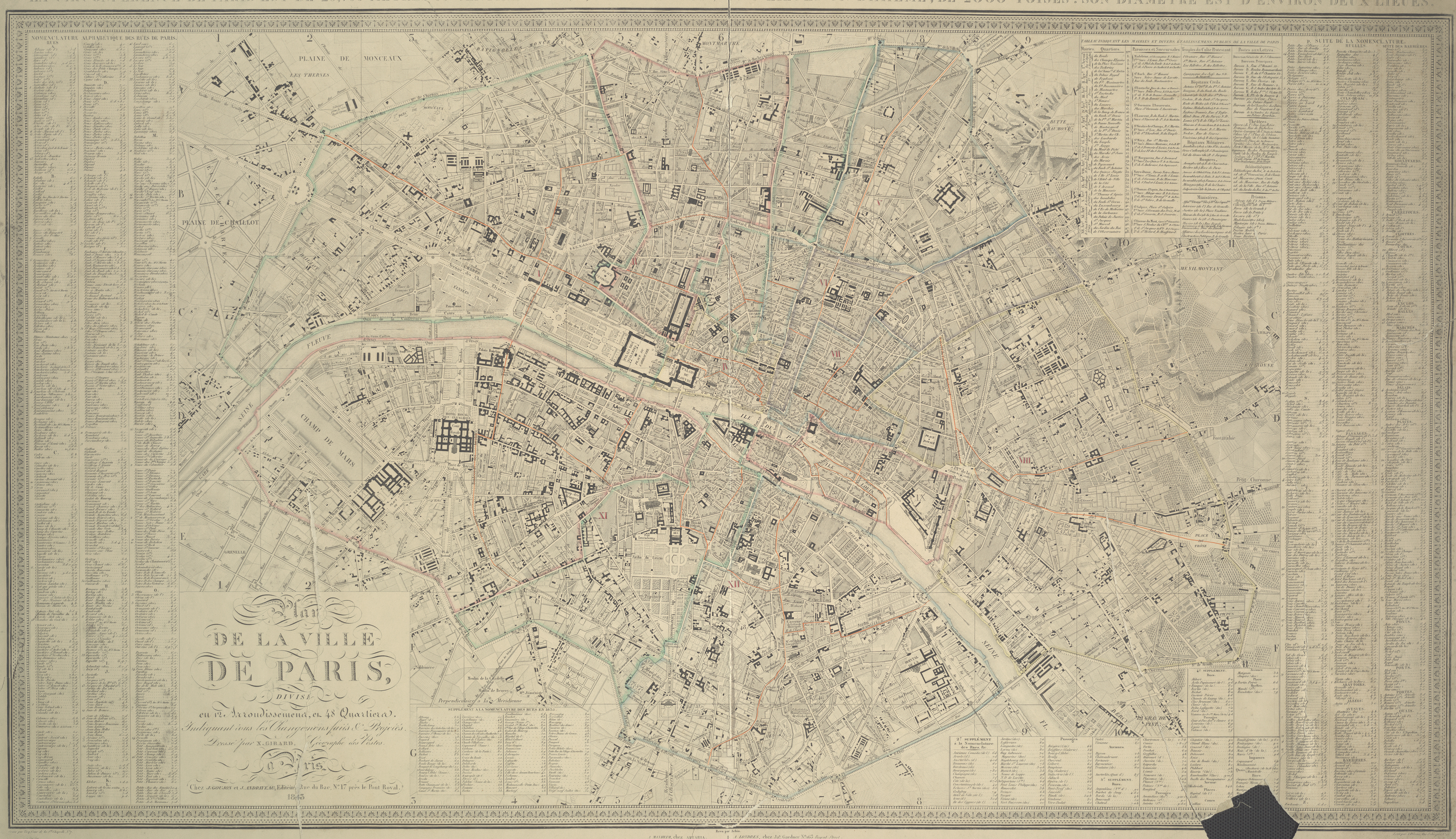
Map of Paris (1843): Very large, very neat to look at, contains the whole city. Pity the text is too small to read in most cases. 2768 x 1596, 7.5mb. (Download image directly)
Map of Paris (1839): Less attractive but more functional--if you know what you're looking for, you can usually read the street names. In PDF format; zoom in until you can read it. Trust me, it's way too big to be an image. 4.7mb.
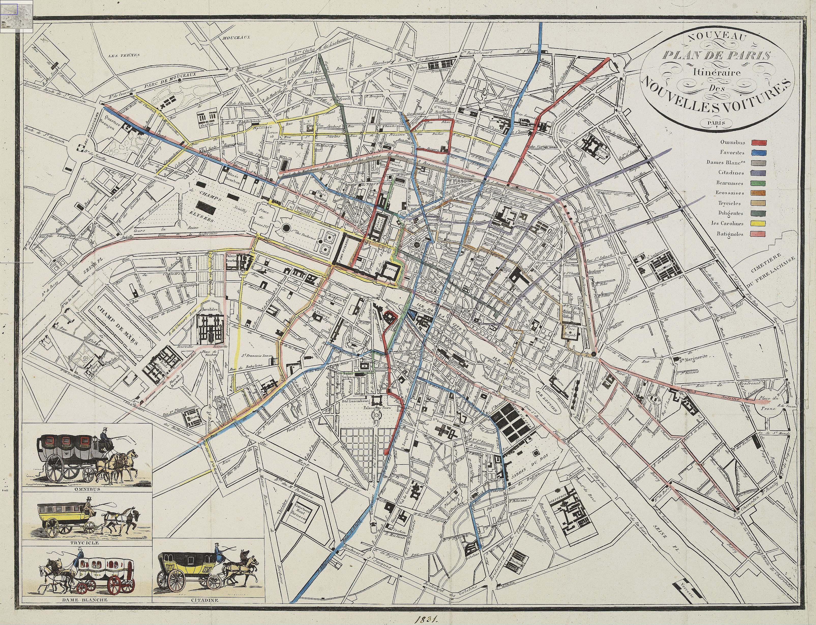
Map of the Paris Omnibus Routes (1831): A very clear but slightly abbreviated map of Paris (some smaller streets and some street names have been left off) that shows the omnibus routes. 3209 x 2457, 2.2mb. (Download image directly)
Right Bank, 1819: Excellent little fragment of an 1819 map, showing the Ile de la Cité and the right bank from the Halles to the Place Royale. 1444 x 1067.
"Insurrectionary quarter" of Paris, 1849: A fragment, showing the area surrounding the rue Saint-Denis. Slightly blurry but legible. Site of the barricade is highlighted in red. 768 x 1024.
Rue de la Chanvrerie: Unknown date. Closeup of the immediate area surrounding the barricade, quite easy to read. 380 x 430.
Montfermeil, between 1825 and 1835: from a map of the towns surrounding Paris. 1200 x 780. [Zoom 1 | Zoom 2 | Zoom 3]
Images
Rue Mondétour, vue prise de la rue Rambuteau: A photograph of the site of the barricade as it existed in 1907, after the rue de la Chanvrerie was destroyed and replaced by the rue Rambuteau. 512 x 728.
Rue Mondétour, entre la rue de la Grande Truanderie et la rue Pirouette: Another segment of the rue Mondétour near where the barricade would have been. It might be helpful to consult the closeup map of the area to visualize where this is. 728 x 512.
Paris and its environs, displayed in a series of two hundred picturesque views: Google Books scan of an 1831 guide to Paris for English tourists. PDF, 20mb.
Links
Cartographie de Paris et de sa banlieue: An excellent site which contains many maps of Paris through the ages.
Historic maps, searchable by street name: A subdivision of the above site that lets you input a street name to see close-ups of it on seven maps from 1705 to the late 19th century. The search itself is a little buggy and doesn't always turn up results, but the concept of a 19th century Mapquest is too cool to pass up.
Nomenclature des voies database: Reliable, fully searchable statistics on every single street in modern Paris, including their histories and former names. In French, but would probably be useable by anyone with Babelfish and a French dictionary. [Seems to be down at the moment, alas.]
Atlas du Patrimonie de la Seine-Saint-Denis: Contains several images and maps of Montfermeil and the surrounding region, as well as some of the greater Paris area.